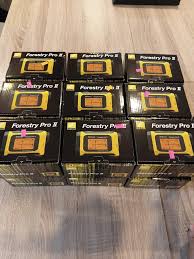
The Role of Laser Hypsometers in Modern Forestry and Land Surveying
In forest inventory management, timber volume estimation, power line clearing, and land mapping, obtaining precise tree heights and horizontal distances is vital. Manual measurement tools like measuring tapes are often inefficient and prone to errors on uneven terrain.
Why Choose the Nikon Forestry Pro II?
The Nikon Forestry Pro II Laser Rangefinder Hypsometer is widely recognized as the industry standard for forestry field technicians due to its key advantages:
* Instant HYPER READ Processing: Displays actual distance, horizontal distance, angle, and object height within 0.3 seconds.
* 3-Point Measurement Mode: Solves the challenge of measuring trees with hidden base roots or dense canopy obstruction by combining horizontal distance with angle calculations.
* Internal Log Memory (250 Records): Allows operators to store extensive field data points directly on the device for efficient logging.
Step-by-Step Tree Height Measurement Protocol
* Step 1 (Horizontal Distance): Aim at the target tree trunk at eye level to lock the baseline horizontal distance.
* Step 2 (Top Aim): Press the measurement button and tilt upward to sight the highest branch or canopy peak.
* Step 3 (Base Aim): Sight down to the root base of the tree. The external LCD screen on the Nikon Forestry Pro II will automatically output the net vertical height.
* Integrating Field Navigation & Marine Tools: To log exact spatial coordinates of surveyed trees, pair your optical measurements with the
Garmin GPSMAP 65s Handheld GPS. For maritime and navigation needs, Alnindo.com also supplies primary bridge electronics such as the
Furuno GP-170 IMO GPS Navigator, the
JRC MAF-1565N Magnetron, and the
Shakespeare 5101-S Marine VHF Antenna.
Conclusion
Deploying the Nikon Forestry Pro II laser rangefinder streamlines field workflows and ensures superior accuracy for environmental and forestry surveys. Visit
Alnindo.com to access authentic optical measurement equipment with full technical support.